Equipment
Sustainable Innovation & Development Lab (SIDL)
Laser Cutting System
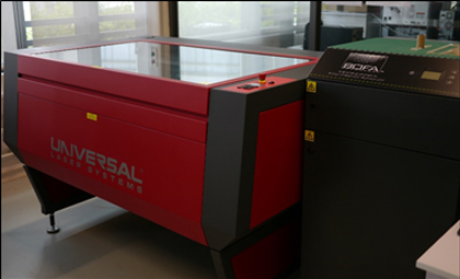
Brand: Universal Laser Systems
Model: iLS 12.75
Application: Laser cutting/engraving
Status: Available
Body Scanning Systems - I
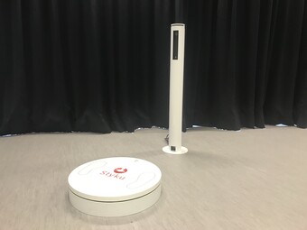
Brand: Styku
Model: 150FH
Application: 3D body scanner with automatic measurement
Status: Available
Body Scanning Systems - II
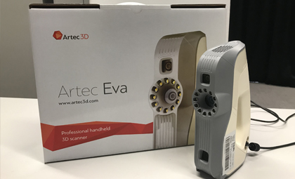
Brand: Artec 3D
Model: EVA
Application: Precise handheld 3D scanner
Status: Available
Motion Capturing Systems
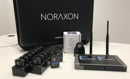
Brand: Noraxon
Model: myomotion
Application: Measurement of human motion
Status: Available
Multi-material 3D printer
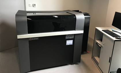
Brand: Stratasys
Model: Objet 350 Connex 3
Application: 3D Printer with adjustable materials properties
Status: Available
Digital Cutting System
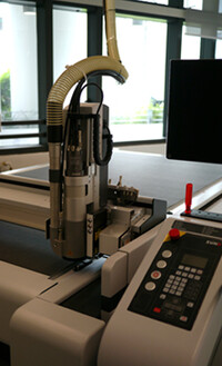
Brand: Zund
Model: G3 M-2500
Application: High speed and precise routing for wood and plastic
Status: Available
Sustainable Living and Environment Lab (SLEL)
Arboriculture System: Resistograph
Brand: IML
Model: Resistograph IML PD-1000
Application: The Resistograph (IML PD-1000) is an efficient urban forestry research tool to monitor and assess wood density for measuring tree health conditions.
Status: Available
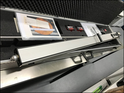
Arboriculture System: Tree Pulling System
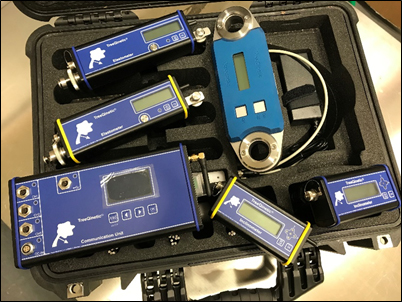
Brand: Argus-electronic gmbh
Model: Tree Pulling System TreeQinetic
Application: The Tree Pulling System (TreeQinetic) reliably assesses the stablility of tree roots and trunks for conducting tree risk evaluations.
Status: Available
Digital Maps, Spatial Data & Satellite Images
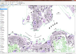
Brand: HKSAR Government Lands Department
Model:
- iB1000
- iB5000
- iB10000
- iB20000
- GEOCOM
- WorldView-2
- Deimos-2 + Pleiades
Application: These digital maps with spatial data and satellite images of Hong Kong are the essential geographical information science resources to conduct and visualize spatial analyses in a wide range of geographical and environmental research topics.
Status: Available
Field survey software and hardware sets for tree inventory
Brand: Field-Map
Model: Field-Map Bundle Rhino
Application: The Field Map Bundle Rhino consists of the tree data collector and GPS data processor which is best applicable to woodland and forestry planning and management.
Status: Available
Drone - I
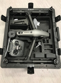
Brand: DJI
Model: Inbspire 2
Application: The Drone (DJI Inspire 2) can provide good quality of aerial photos and video for researching in natural nad built environments.
Drone - II
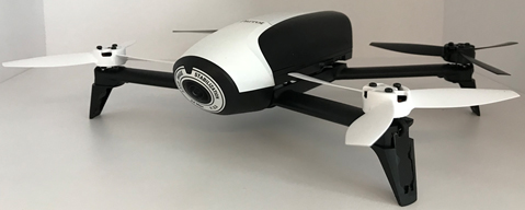
Brand: Parrot
Model: Bebop Pro 3D modeling
Application: The Drone (Parrot Bebop Pro 3D Modelling) is exceptionally capable drone in both capturing aerial photos and videos for building 3D modeling.
Status: Available
Laser Rangefinder
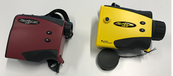
Brand: Laser Tech
Model:
- TruPulse 200L
- TruPulse 200M
Application: The Laser Rangefinder (TruPulse 200L and TruPulse 200B) utilizes the laser beam to measure the distance to an object in outdoor field surveys. These tools are a helpful tool for measuring the slope distance and inclination that can enhance researchers and surveyors in building inspections, field surveys, dimension checking and layout planning etc.
Status: Available
Handheld GPS Device - I
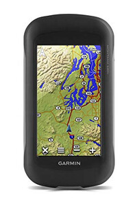
Brand: Germin
Model:
- Montana 680t
Application: The Garmin Montana 680t is portable handheld device with GPS and camera functions for collecting geographical informaiton from outdoor surveys.
Status: Available
Handheld GPS Device - II
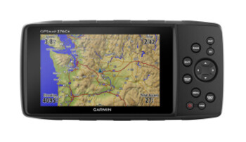
Brand: Germin
Model: GPSMAP276x
Application: The Garmin GPSMAP276x is a user-friendly hand-held device equipped with Wi-Fi and bluetooth features for conveniently obtaining and transferring useful geographical data from otudoor research environment.
Status: Available